BlocHub’s Geospatial Collaboration with GVL
A Geospatial Partnership
Bloc Digital is proud to partner with Geospatial Ventures Ltd (GVL) in a new collaboration that combines advanced remote sensing, powerful visualisation and geospatial innovation.
By integrating Bloc Digital’s BlocHub platform, designed for 3D model visualisation and data analytics with GVL’s deep knowledge of Earth observation and InSAR (Interferometric Synthetic Aperture Radar), the product can turn complex satellite data into clear, actionable insights for planning, monitoring, and decision-making.
Resulting in clear geospatial data and usable insights that GVL can analyse, visualise and communicate effectively.
InSAR Insights for Real-World Challenges
InSAR uses satellite radar to detect small ground movements that can signal subsidence, landslides or other structural risks. Monitoring ground movement by comparing radar images of the same area taken at different times.
It’s a critical tool for identifying risks like subsidence, landslides, and structural instability, especially in areas vulnerable to seismic activity or shifting terrain. BlocHub supports informed decisions in infrastructure planning, environmental monitoring, and public safety.
-bloc-digital.jpg)
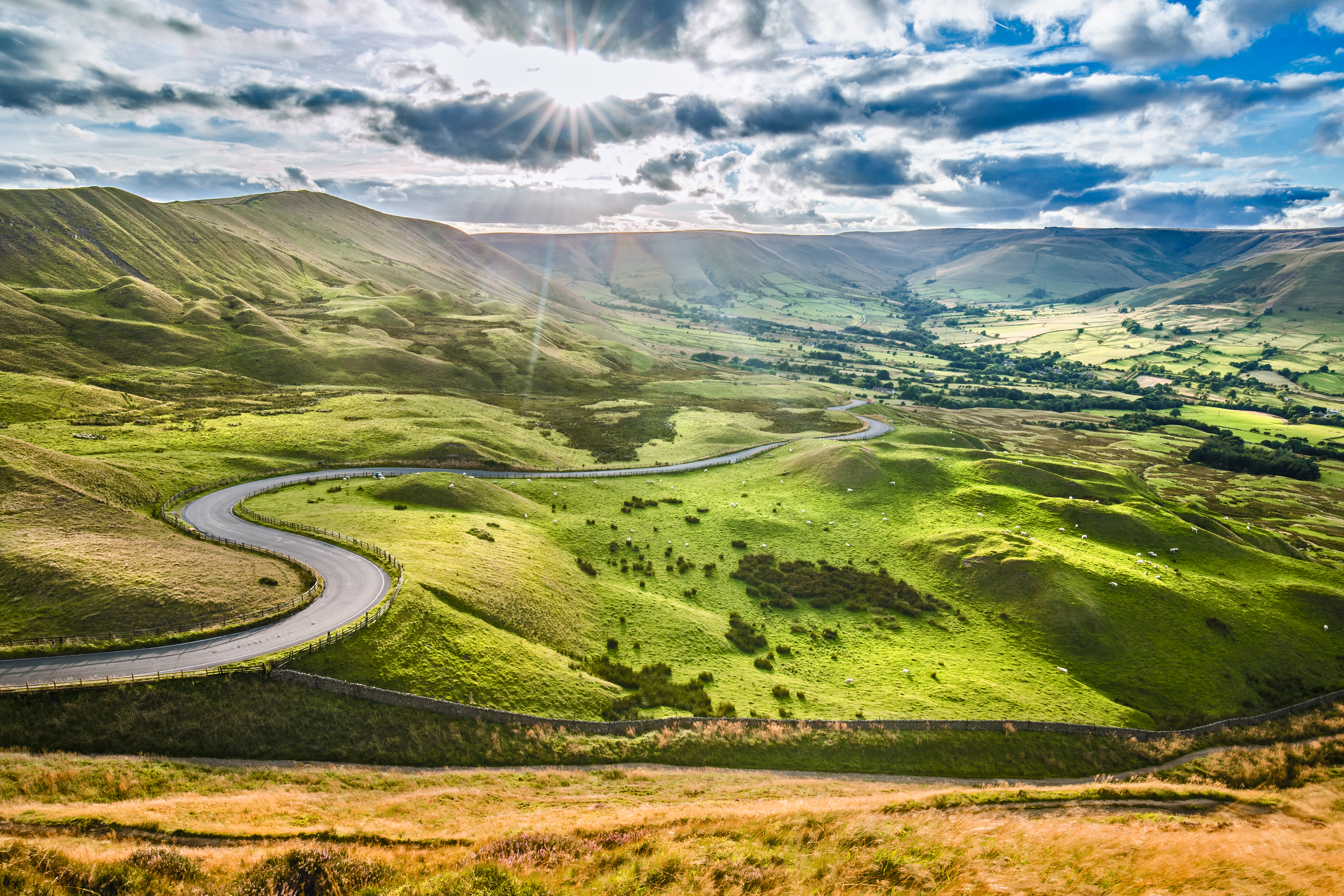
Mapping the Shifting Landscape of Snake Pass
One of the first applications of this collaboration is focused on the world-renowned site ‘Snake Pass’ located in the Derbyshire section of the Peak District. Prone to landslides, weather damage, and frequent closures, it presents a serious challenge for maintenance teams and planners, particularly with erosion damage on public roads.
Through BlocHub’s digital twin capabilities and GVL’s InSAR data, the project delivers high-resolution 3D models and historical surface deformation tracking, offering a smarter way to understand and manage evolving landscapes.
Snake Pass Reimagined Through Data
This initiative reimagines Snake Pass through data but also showcases how our partnership is paving the way for safer, more efficient infrastructure management across the UK. It’s a prime example of geospatial innovation making a difference.
BlocHub and GVL are leading innovations in geospatial and infrastructure monitoring, solving real-world challenges with cutting-edge digital tools together.